


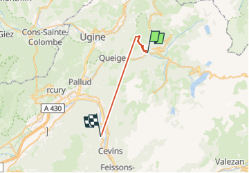
Mont Bisanne

whisper73
User

Length
23 km

Max alt
2158 m

Uphill gradient
3284 m
Km-Effort
67 km

Min alt
360 m

Downhill gradient
3518 m
Boucle
No
Creation date :
2025-04-05 06:01:08.993
Updated on :
2025-04-05 11:54:20.225
2h25
Difficulty : Very difficult
1h10
Difficulty : Very easy

FREE GPS app for hiking
 SityTrail
IGN / Geographical institutes
SityTrail Plus
The world is yours!
About
Trail Walking of 23 km to be discovered at Auvergne-Rhône-Alpes, Savoy, Villard-sur-Doron. This trail is proposed by whisper73.
Positioning
Country:
France
Region :
Auvergne-Rhône-Alpes
Department/Province :
Savoy
Municipality :
Villard-sur-Doron
Location:
Unknown
Start:(Dec)
Start:(UTM)
307801 ; 5066608 (32T) N.
Comments