


250406 ski

Julliengamo
User

Length
51 km

Max alt
2583 m

Uphill gradient
4972 m
Km-Effort
121 km

Min alt
1522 m

Downhill gradient
5968 m
Boucle
No
Creation date :
2025-04-06 07:30:11.295
Updated on :
2025-04-06 10:24:45.503
2h54
Difficulty : Very easy

FREE GPS app for hiking
 SityTrail
IGN / Geographical institutes
SityTrail Plus
The world is yours!
About
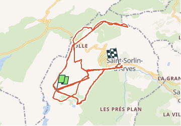
Trail Alpine skiing of 51 km to be discovered at Auvergne-Rhône-Alpes, Savoy, Saint-Sorlin-d'Arves. This trail is proposed by Julliengamo.
Positioning
Country:
France
Region :
Auvergne-Rhône-Alpes
Department/Province :
Savoy
Municipality :
Saint-Sorlin-d'Arves
Location:
Unknown
Start:(Dec)
Start:(UTM)
278731 ; 5009998 (32T) N.
Comments