


aleyrac citelles

losjo
User
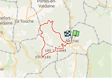

Length
13.4 km

Max alt
474 m

Uphill gradient
349 m
Km-Effort
18.1 km

Min alt
323 m

Downhill gradient
346 m
Boucle
Yes
Creation date :
2025-04-07 16:14:40.942
Updated on :
2025-04-07 16:17:54.706
4h06
Difficulty : Easy

FREE GPS app for hiking
 SityTrail
IGN / Geographical institutes
SityTrail Plus
The world is yours!
About
Trail On foot of 13.4 km to be discovered at Auvergne-Rhône-Alpes, Drôme, Aleyrac. This trail is proposed by losjo.
Positioning
Country:
France
Region :
Auvergne-Rhône-Alpes
Department/Province :
Drôme
Municipality :
Aleyrac
Location:
Unknown
Start:(Dec)
Start:(UTM)
654137 ; 4929223 (31T) N.
Comments