


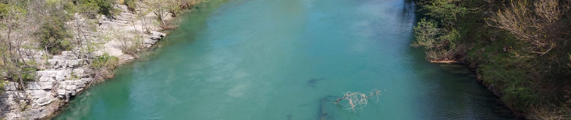
saint Étienne issenssac ravin des arcs

labarone
User
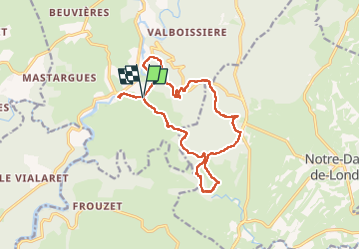

Length
16.7 km

Max alt
370 m

Uphill gradient
531 m
Km-Effort
24 km

Min alt
105 m

Downhill gradient
531 m
Boucle
Yes
Creation date :
2025-04-08 06:47:08.705
Updated on :
2025-04-08 13:05:53.117
6h17
Difficulty : Medium

FREE GPS app for hiking
 SityTrail
IGN / Geographical institutes
SityTrail Plus
The world is yours!
About
Trail Walking of 16.7 km to be discovered at Occitania, Hérault, Brissac. This trail is proposed by labarone.
Description
belle rando chemin caillouteux
Photos


Positioning
Country:
France
Region :
Occitania
Department/Province :
Hérault
Municipality :
Brissac
Location:
Unknown
Start:(Dec)
Start:(UTM)
556963 ; 4854707 (31T) N.
Comments