


Saou

raygautier
User
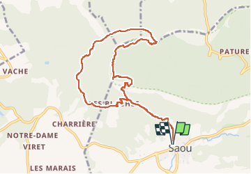

Length
10.2 km

Max alt
874 m

Uphill gradient
649 m
Km-Effort
18.9 km

Min alt
331 m

Downhill gradient
650 m
Boucle
Yes
Creation date :
2025-04-08 09:43:31.0
Updated on :
2025-04-08 15:58:11.287
6h08
Difficulty : Difficult

FREE GPS app for hiking
 SityTrail
IGN / Geographical institutes
SityTrail Plus
The world is yours!
About
Trail Walking of 10.2 km to be discovered at Auvergne-Rhône-Alpes, Drôme, Saou. This trail is proposed by raygautier.
Positioning
Country:
France
Region :
Auvergne-Rhône-Alpes
Department/Province :
Drôme
Municipality :
Saou
Location:
Unknown
Start:(Dec)
Start:(UTM)
663434 ; 4945753 (31T) N.
Comments