


POURCHERES

raygautier
User
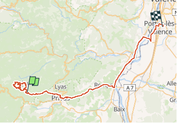

Length
64 km

Max alt
848 m

Uphill gradient
1015 m
Km-Effort
80 km

Min alt
86 m

Downhill gradient
1590 m
Boucle
No
Creation date :
2025-04-10 07:21:51.0
Updated on :
2025-04-11 08:26:02.492
23h03
Difficulty : Very difficult

FREE GPS app for hiking
 SityTrail
IGN / Geographical institutes
SityTrail Plus
The world is yours!
About
Trail Walking of 64 km to be discovered at Auvergne-Rhône-Alpes, Ardèche, Pourchères. This trail is proposed by raygautier.
Positioning
Country:
France
Region :
Auvergne-Rhône-Alpes
Department/Province :
Ardèche
Municipality :
Pourchères
Location:
Unknown
Start:(Dec)
Start:(UTM)
619252 ; 4955932 (31T) N.
Comments