


cospron

ISAGIL
User
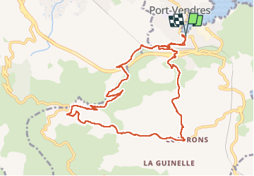

Length
12.5 km

Max alt
226 m

Uphill gradient
333 m
Km-Effort
16.9 km

Min alt
2 m

Downhill gradient
334 m
Boucle
Yes
Creation date :
2025-04-11 11:38:35.247
Updated on :
2025-04-11 15:39:20.236
3h59
Difficulty : Difficult

FREE GPS app for hiking
 SityTrail
IGN / Geographical institutes
SityTrail Plus
The world is yours!
About
Trail Walking of 12.5 km to be discovered at Occitania, Pyrénées-Orientales, Port-Vendres. This trail is proposed by ISAGIL.
Description
cospron
Photos


Positioning
Country:
France
Region :
Occitania
Department/Province :
Pyrénées-Orientales
Municipality :
Port-Vendres
Location:
Unknown
Start:(Dec)
Start:(UTM)
508788 ; 4707047 (31T) N.
Comments