


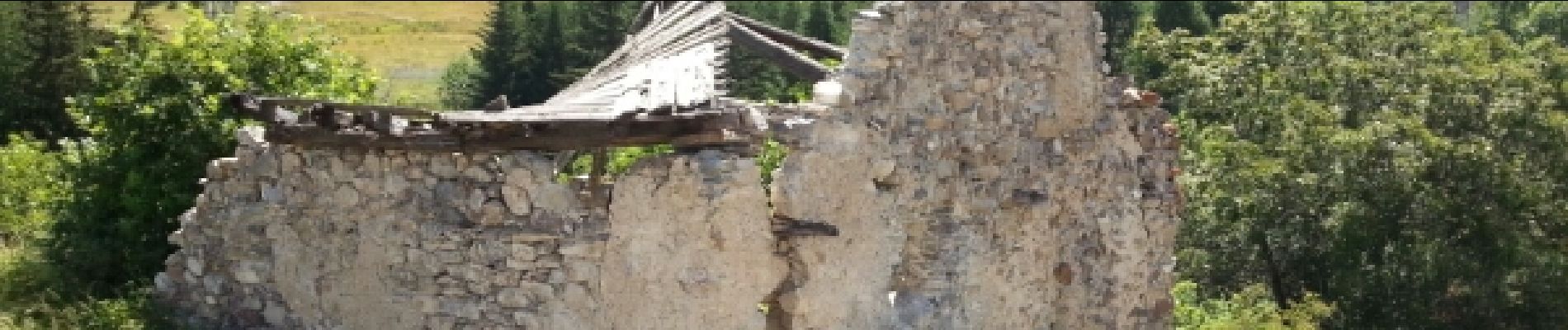
boucle sainte Catherine

marmotte83
User
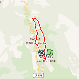

Length
5.3 km

Max alt
1870 m

Uphill gradient
232 m
Km-Effort
8.4 km

Min alt
1637 m

Downhill gradient
234 m
Boucle
Yes
Creation date :
2015-07-07 00:00:00.0
Updated on :
2015-07-07 00:00:00.0
2h34
Difficulty : Very easy

FREE GPS app for hiking
 SityTrail
IGN / Geographical institutes
SityTrail Plus
The world is yours!
About
Trail Walking of 5.3 km to be discovered at Provence-Alpes-Côte d'Azur, Hautes-Alpes, Vars. This trail is proposed by marmotte83.
Description
Boucle sympathique et familiale. Il est recommandé de partie vers les 9h00 du matin. La chaleur vient vite sur le retour. le chemin est parsemé de point d'eau pour se rafraichir.
Photos


Positioning
Country:
France
Region :
Provence-Alpes-Côte d'Azur
Department/Province :
Hautes-Alpes
Municipality :
Vars
Location:
Unknown
Start:(Dec)
Start:(UTM)
317009 ; 4941394 (32T) N.
Comments