


MONT ST MICHEL Curienne-18-04-25
mini balades Adapar
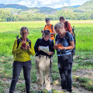
Une équipe à votre service garant de convivialité et bonne humeur
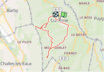

Length
7.5 km

Max alt
879 m

Uphill gradient
289 m
Km-Effort
11.3 km

Min alt
689 m

Downhill gradient
291 m
Boucle
Yes
Creation date :
2025-04-14 16:05:36.268
Updated on :
2025-04-14 16:06:51.568
2h34
Difficulty : Medium

FREE GPS app for hiking
 SityTrail
IGN / Geographical institutes
SityTrail Plus
The world is yours!
About
Trail Walking of 7.5 km to be discovered at Auvergne-Rhône-Alpes, Savoy, Curienne. This trail is proposed by mini balades Adapar.
Positioning
Country:
France
Region :
Auvergne-Rhône-Alpes
Department/Province :
Savoy
Municipality :
Curienne
Location:
Unknown
Start:(Dec)
Start:(UTM)
266620 ; 5050188 (32T) N.
Comments