


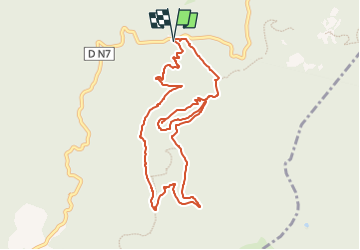
Variante de l'Aigre /pas d'Adam/ les cantonniers

Michel DUBOIS
User

Length
10.4 km

Max alt
444 m

Uphill gradient
359 m
Km-Effort
15.2 km

Min alt
212 m

Downhill gradient
353 m
Boucle
Yes
Creation date :
2025-04-16 16:37:59.977
Updated on :
2025-04-16 16:41:43.465
3h26
Difficulty : Easy

FREE GPS app for hiking
 SityTrail
IGN / Geographical institutes
SityTrail Plus
The world is yours!
About
Trail Walking of 10.4 km to be discovered at Provence-Alpes-Côte d'Azur, Var, Fréjus. This trail is proposed by Michel DUBOIS.
Description
pour faire à la matinée raccoucie de 4 kms
Positioning
Country:
France
Region :
Provence-Alpes-Côte d'Azur
Department/Province :
Var
Municipality :
Fréjus
Location:
Unknown
Start:(Dec)
Start:(UTM)
321691 ; 4818854 (32T) N.
Comments