


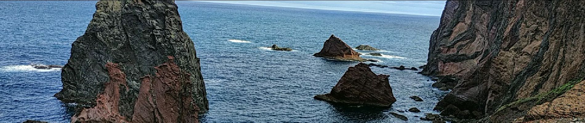
2025-03-27 pointe de sao lourenco

jacq58
User
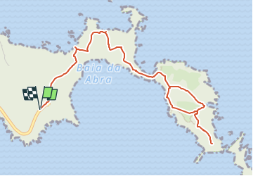

Length
7.6 km

Max alt
136 m

Uphill gradient
469 m
Km-Effort
13.9 km

Min alt
0 m

Downhill gradient
469 m
Boucle
Yes
Creation date :
2025-04-18 18:23:00.977
Updated on :
2025-04-18 18:45:22.754
3h08
Difficulty : Difficult

FREE GPS app for hiking
 SityTrail
IGN / Geographical institutes
SityTrail Plus
The world is yours!
About
Trail Walking of 7.6 km to be discovered at Madeira, Unknown, Caniçal. This trail is proposed by jacq58.
Description
Rando sans difficulté particulière, sauf pour le Miradouro Ponta do Furado sommet final qui est interdit et le sentier dangereux.
Photos


Positioning
Country:
Portugal
Region :
Madeira
Department/Province :
Unknown
Municipality :
Caniçal
Location:
Unknown
Start:(Dec)
Start:(UTM)
340543 ; 3624030 (28S) N.
Comments