


Cucugnan - Champ de Hoste

Guy Laurent
User
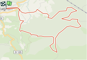

Length
7.9 km

Max alt
622 m

Uphill gradient
422 m
Km-Effort
13.6 km

Min alt
264 m

Downhill gradient
423 m
Boucle
Yes
Creation date :
2025-04-19 15:08:07.11
Updated on :
2025-04-19 15:10:17.62
3h04
Difficulty : Difficult

FREE GPS app for hiking
 SityTrail
IGN / Geographical institutes
SityTrail Plus
The world is yours!
About
Trail Walking of 7.9 km to be discovered at Occitania, Aude, Cucugnan. This trail is proposed by Guy Laurent.
Positioning
Country:
France
Region :
Occitania
Department/Province :
Aude
Municipality :
Cucugnan
Location:
Unknown
Start:(Dec)
Start:(UTM)
467549 ; 4744334 (31T) N.
Comments