


GRPLL-Pierre JJ Rousseau-D321

COMAN
User
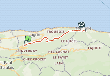

Length
6.6 km

Max alt
652 m

Uphill gradient
238 m
Km-Effort
10.1 km

Min alt
461 m

Downhill gradient
318 m
Boucle
No
Creation date :
2015-07-08 00:00:00.0
Updated on :
2015-07-08 00:00:00.0
--
Difficulty : Unknown

FREE GPS app for hiking
 SityTrail
IGN / Geographical institutes
SityTrail Plus
The world is yours!
About
Trail Walking of 6.6 km to be discovered at Auvergne-Rhône-Alpes, Upper Savoy, Lugrin. This trail is proposed by COMAN.
Positioning
Country:
France
Region :
Auvergne-Rhône-Alpes
Department/Province :
Upper Savoy
Municipality :
Lugrin
Location:
Unknown
Start:(Dec)
Start:(UTM)
319537 ; 5140474 (32T) N.
Comments