


bouligny

jcb48
User
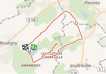

Length
8.9 km

Max alt
310 m

Uphill gradient
93 m
Km-Effort
10.1 km

Min alt
254 m

Downhill gradient
93 m
Boucle
Yes
Creation date :
2025-04-24 12:06:53.476
Updated on :
2025-04-24 14:53:28.926
2h46
Difficulty : Medium

FREE GPS app for hiking
 SityTrail
IGN / Geographical institutes
SityTrail Plus
The world is yours!
About
Trail Walking of 8.9 km to be discovered at Grand Est, Meuse, Bouligny. This trail is proposed by jcb48.
Positioning
Country:
France
Region :
Grand Est
Department/Province :
Meuse
Municipality :
Bouligny
Location:
Unknown
Start:(Dec)
Start:(UTM)
699842 ; 5463229 (31U) N.
Comments