


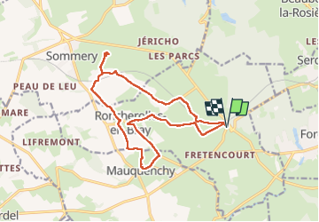
roncherolles en bray

Laurent53
User

Length
15.7 km

Max alt
192 m

Uphill gradient
221 m
Km-Effort
18.6 km

Min alt
134 m

Downhill gradient
221 m
Boucle
Yes
Creation date :
2025-04-25 08:06:13.623
Updated on :
2025-04-25 15:33:48.386
7h27
Difficulty : Difficult

FREE GPS app for hiking
 SityTrail
IGN / Geographical institutes
SityTrail Plus
The world is yours!
About
Trail Walking of 15.7 km to be discovered at Normandy, Seine-Maritime, Roncherolles-en-Bray. This trail is proposed by Laurent53.
Positioning
Country:
France
Region :
Normandy
Department/Province :
Seine-Maritime
Municipality :
Roncherolles-en-Bray
Location:
Unknown
Start:(Dec)
Start:(UTM)
391725 ; 5496864 (31U) N.
Comments