


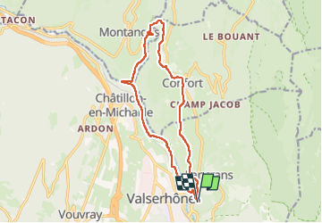
Boucle VALSERINE

Jean-Paulchoux
User

Length
14.6 km

Max alt
560 m

Uphill gradient
359 m
Km-Effort
19.4 km

Min alt
347 m

Downhill gradient
359 m
Boucle
Yes
Creation date :
2025-04-27 06:47:55.723
Updated on :
2025-04-29 11:09:32.853
4h05
Difficulty : Medium

FREE GPS app for hiking
 SityTrail
IGN / Geographical institutes
SityTrail Plus
The world is yours!
About
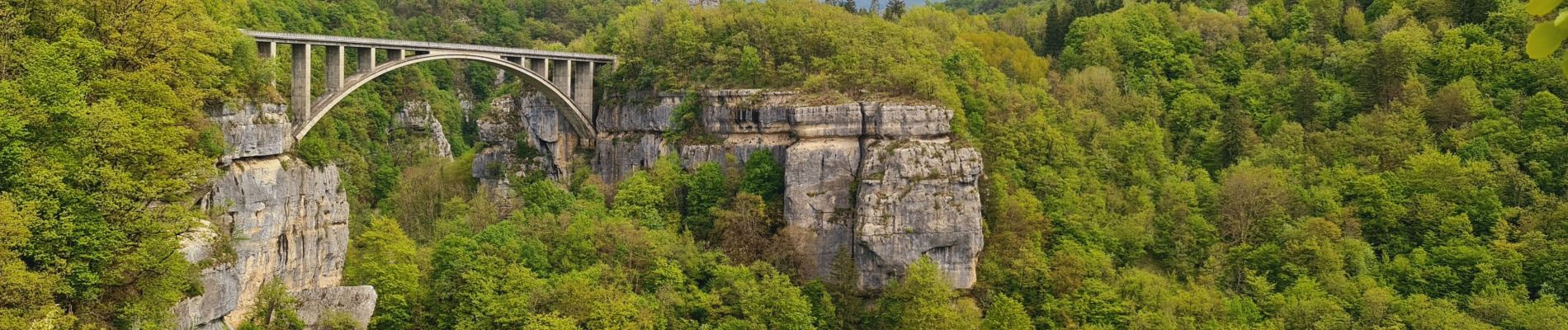
Trail Walking of 14.6 km to be discovered at Auvergne-Rhône-Alpes, Ain, Valserhône. This trail is proposed by Jean-Paulchoux.
Photos


Positioning
Country:
France
Region :
Auvergne-Rhône-Alpes
Department/Province :
Ain
Municipality :
Valserhône
Location:
Lancrans
Start:(Dec)
Start:(UTM)
718542 ; 5111041 (31T) N.
Comments