


la claree 2

avdem
User
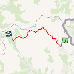

Length
18.6 km

Max alt
2832 m

Uphill gradient
1270 m
Km-Effort
34 km

Min alt
1760 m

Downhill gradient
875 m
Boucle
No
Creation date :
2015-07-11 00:00:00.0
Updated on :
2015-07-11 00:00:00.0
10h19
Difficulty : Unknown

FREE GPS app for hiking
 SityTrail
IGN / Geographical institutes
SityTrail Plus
The world is yours!
About
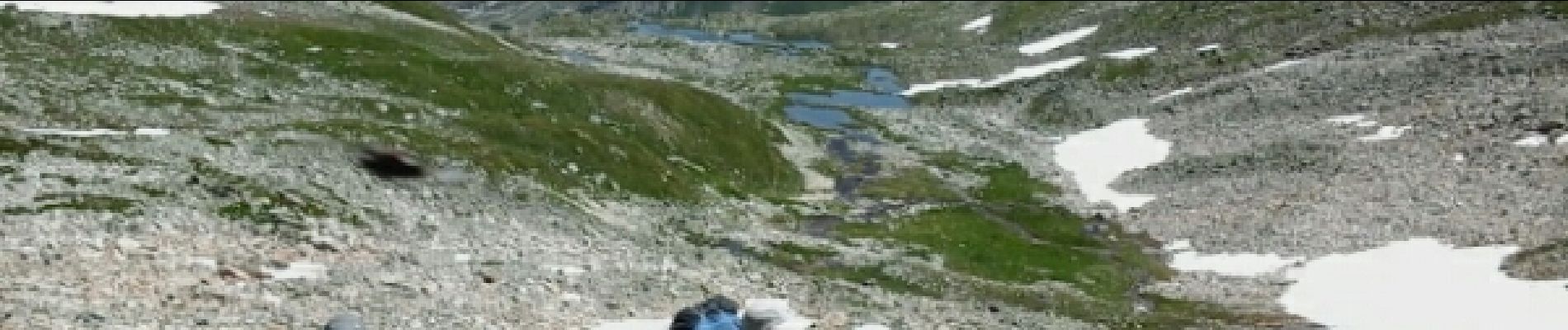
Trail Other activity of 18.6 km to be discovered at Provence-Alpes-Côte d'Azur, Hautes-Alpes, Névache. This trail is proposed by avdem.
Description
la claree 2 Drayere
Photos


Positioning
Country:
France
Region :
Provence-Alpes-Côte d'Azur
Department/Province :
Hautes-Alpes
Municipality :
Névache
Location:
Unknown
Start:(Dec)
Start:(UTM)
312896 ; 4993417 (32T) N.
Comments