


la clareela

avdem
User
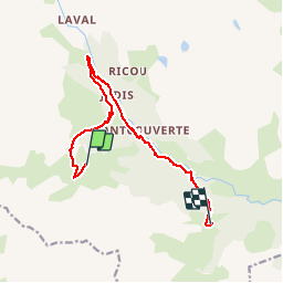

Length
12.9 km

Max alt
2249 m

Uphill gradient
380 m
Km-Effort
18.5 km

Min alt
1812 m

Downhill gradient
539 m
Boucle
No
Creation date :
2015-07-11 00:00:00.0
Updated on :
2015-07-11 00:00:00.0
6h42
Difficulty : Unknown

FREE GPS app for hiking
 SityTrail
IGN / Geographical institutes
SityTrail Plus
The world is yours!
About
Trail Other activity of 12.9 km to be discovered at Provence-Alpes-Côte d'Azur, Hautes-Alpes, Névache. This trail is proposed by avdem.
Description
La claree 5 refuge laBuffere
Photos


Positioning
Country:
France
Region :
Provence-Alpes-Côte d'Azur
Department/Province :
Hautes-Alpes
Municipality :
Névache
Location:
Unknown
Start:(Dec)
Start:(UTM)
305567 ; 4988757 (32T) N.
Comments