


Thuin Aulne Lobbes Thuin

ameurant
User
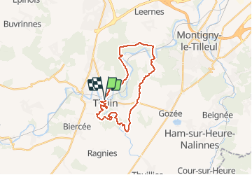

Length
22 km

Max alt
208 m

Uphill gradient
457 m
Km-Effort
28 km

Min alt
106 m

Downhill gradient
454 m
Boucle
Yes
Creation date :
2015-07-11 00:00:00.0
Updated on :
2015-07-11 00:00:00.0
6h03
Difficulty : Easy

FREE GPS app for hiking
 SityTrail
IGN / Geographical institutes
SityTrail Plus
The world is yours!
About
Trail Walking of 22 km to be discovered at Wallonia, Hainaut, Thuin. This trail is proposed by ameurant.
Positioning
Country:
Belgium
Region :
Wallonia
Department/Province :
Hainaut
Municipality :
Thuin
Location:
Thuin
Start:(Dec)
Start:(UTM)
591565 ; 5577440 (31U) N.
Comments