


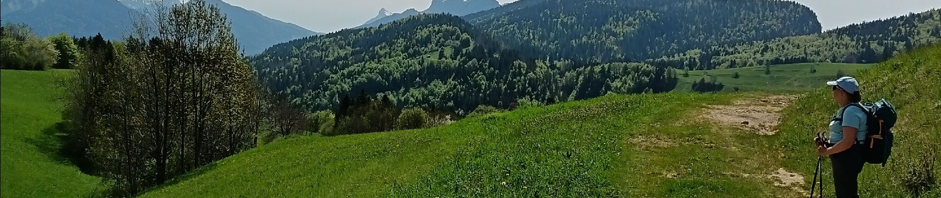
col du mollard et des fontanettes

pierrounet
User
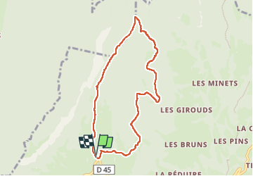

Length
8.3 km

Max alt
1335 m

Uphill gradient
379 m
Km-Effort
13.3 km

Min alt
1170 m

Downhill gradient
383 m
Boucle
Yes
Creation date :
2025-05-02 09:17:18.219
Updated on :
2025-05-02 13:14:55.598
3h57
Difficulty : Difficult

FREE GPS app for hiking
 SityTrail
IGN / Geographical institutes
SityTrail Plus
The world is yours!
About
Trail Walking of 8.3 km to be discovered at Auvergne-Rhône-Alpes, Savoy, Entremont-le-Vieux. This trail is proposed by pierrounet.
Photos


Positioning
Country:
France
Region :
Auvergne-Rhône-Alpes
Department/Province :
Savoy
Municipality :
Entremont-le-Vieux
Location:
Unknown
Start:(Dec)
Start:(UTM)
723808 ; 5038721 (31T) N.
Comments