


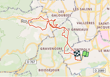
Beaumont-Royat-Beaumont

jpcccb
User

Length
10.1 km

Max alt
585 m

Uphill gradient
318 m
Km-Effort
14.3 km

Min alt
456 m

Downhill gradient
319 m
Boucle
Yes
Creation date :
2025-05-05 09:02:43.848
Updated on :
2025-05-05 09:03:27.338
3h15
Difficulty : Difficult

FREE GPS app for hiking
 SityTrail
IGN / Geographical institutes
SityTrail Plus
The world is yours!
About
Trail Walking of 10.1 km to be discovered at Auvergne-Rhône-Alpes, Puy-de-Dôme, Beaumont. This trail is proposed by jpcccb.
Positioning
Country:
France
Region :
Auvergne-Rhône-Alpes
Department/Province :
Puy-de-Dôme
Municipality :
Beaumont
Location:
Unknown
Start:(Dec)
Start:(UTM)
506112 ; 5066150 (31T) N.
Comments