


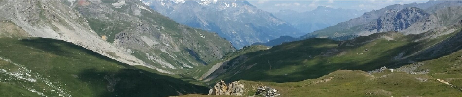
Lacs long et rond par refuge du Thabor - 11 juil 2015

morganee
User
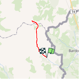

Length
19.6 km

Max alt
2519 m

Uphill gradient
864 m
Km-Effort
31 km

Min alt
1720 m

Downhill gradient
864 m
Boucle
Yes
Creation date :
2019-07-19 19:06:07.441
Updated on :
2019-07-19 19:06:07.577
6h25
Difficulty : Medium

FREE GPS app for hiking
 SityTrail
IGN / Geographical institutes
SityTrail Plus
The world is yours!
About
Trail Walking of 19.6 km to be discovered at Provence-Alpes-Côte d'Azur, Hautes-Alpes, Névache. This trail is proposed by morganee.
Photos

Positioning
Country:
France
Region :
Provence-Alpes-Côte d'Azur
Department/Province :
Hautes-Alpes
Municipality :
Névache
Location:
Unknown
Start:(Dec)
Start:(UTM)
313362 ; 4993128 (32T) N.
Comments