


mont St Honorat

franquen
User
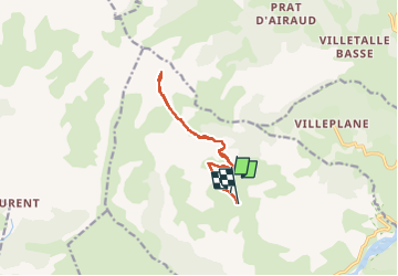

Length
11.6 km

Max alt
2468 m

Uphill gradient
939 m
Km-Effort
24 km

Min alt
1457 m

Downhill gradient
1005 m
Boucle
No
Creation date :
2025-05-06 06:46:25.24
Updated on :
2025-05-06 13:03:19.196
6h16
Difficulty : Very difficult

FREE GPS app for hiking
 SityTrail
IGN / Geographical institutes
SityTrail Plus
The world is yours!
About
Trail Walking of 11.6 km to be discovered at Provence-Alpes-Côte d'Azur, Maritime Alps, Daluis. This trail is proposed by franquen.
Positioning
Country:
France
Region :
Provence-Alpes-Côte d'Azur
Department/Province :
Maritime Alps
Municipality :
Daluis
Location:
Unknown
Start:(Dec)
Start:(UTM)
322619 ; 4879502 (32T) N.
Comments