


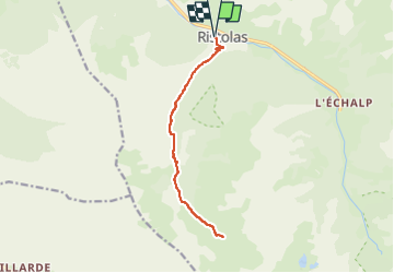
Queyras-Lac de Ségure

nicolas54230
User

Length
13.7 km

Max alt
2413 m

Uphill gradient
802 m
Km-Effort
24 km

Min alt
1616 m

Downhill gradient
803 m
Boucle
Yes
Creation date :
2025-05-08 07:54:17.085
Updated on :
2025-05-08 07:54:55.17
5h32
Difficulty : Very difficult

FREE GPS app for hiking
 SityTrail
IGN / Geographical institutes
SityTrail Plus
The world is yours!
About
Trail Walking of 13.7 km to be discovered at Provence-Alpes-Côte d'Azur, Hautes-Alpes, Abriès-Ristolas. This trail is proposed by nicolas54230.
Positioning
Country:
France
Region :
Provence-Alpes-Côte d'Azur
Department/Province :
Hautes-Alpes
Municipality :
Abriès-Ristolas
Location:
Unknown
Start:(Dec)
Start:(UTM)
338049 ; 4959898 (32T) N.
Comments