


Queyras-Aiguilles-Trois lacs du Malrif

nicolas54230
User

Length
14.4 km

Max alt
2737 m

Uphill gradient
1253 m
Km-Effort
31 km

Min alt
1477 m

Downhill gradient
1253 m
Boucle
Yes
Creation date :
2025-05-08 08:06:19.738
Updated on :
2025-05-08 08:07:09.887
7h04
Difficulty : Very difficult

FREE GPS app for hiking
 SityTrail
IGN / Geographical institutes
SityTrail Plus
The world is yours!
About
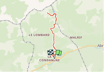
Trail Walking of 14.4 km to be discovered at Provence-Alpes-Côte d'Azur, Hautes-Alpes, Aiguilles. This trail is proposed by nicolas54230.
Positioning
Country:
France
Region :
Provence-Alpes-Côte d'Azur
Department/Province :
Hautes-Alpes
Municipality :
Aiguilles
Location:
Unknown
Start:(Dec)
Start:(UTM)
331541 ; 4961010 (32T) N.
Comments