


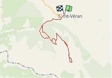
Queyras-Saint Véran-Croix de Curlet-Pic Cascavelier

nicolas54230
User

Length
9.4 km

Max alt
2561 m

Uphill gradient
829 m
Km-Effort
20 km

Min alt
1849 m

Downhill gradient
830 m
Boucle
Yes
Creation date :
2025-05-08 08:16:11.828
Updated on :
2025-05-08 08:17:11.224
4h38
Difficulty : Very difficult

FREE GPS app for hiking
 SityTrail
IGN / Geographical institutes
SityTrail Plus
The world is yours!
About
Trail Walking of 9.4 km to be discovered at Provence-Alpes-Côte d'Azur, Hautes-Alpes, Saint-Véran. This trail is proposed by nicolas54230.
Positioning
Country:
France
Region :
Provence-Alpes-Côte d'Azur
Department/Province :
Hautes-Alpes
Municipality :
Saint-Véran
Location:
Unknown
Start:(Dec)
Start:(UTM)
330901 ; 4951795 (32T) N.
Comments