


Queyras-Col de Lacroix-Spmmet Praroussin (IT)

nicolas54230
User
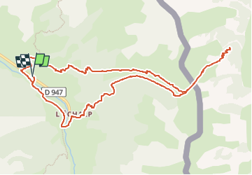

Length
13 km

Max alt
2312 m

Uphill gradient
961 m
Km-Effort
26 km

Min alt
1653 m

Downhill gradient
962 m
Boucle
Yes
Creation date :
2025-05-12 09:03:15.628
Updated on :
2025-05-12 09:04:23.764
5h52
Difficulty : Very difficult

FREE GPS app for hiking
 SityTrail
IGN / Geographical institutes
SityTrail Plus
The world is yours!
About
Trail Walking of 13 km to be discovered at Provence-Alpes-Côte d'Azur, Hautes-Alpes, Abriès-Ristolas. This trail is proposed by nicolas54230.
Positioning
Country:
France
Region :
Provence-Alpes-Côte d'Azur
Department/Province :
Hautes-Alpes
Municipality :
Abriès-Ristolas
Location:
Ristolas
Start:(Dec)
Start:(UTM)
340443 ; 4958941 (32T) N.
Comments