


Bornas à Saint baudille

labarone
User
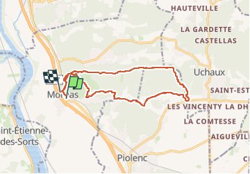

Length
16.3 km

Max alt
186 m

Uphill gradient
417 m
Km-Effort
22 km

Min alt
36 m

Downhill gradient
414 m
Boucle
No
Creation date :
2025-05-13 06:51:58.344
Updated on :
2025-05-13 13:01:22.527
6h08
Difficulty : Medium

FREE GPS app for hiking
 SityTrail
IGN / Geographical institutes
SityTrail Plus
The world is yours!
About
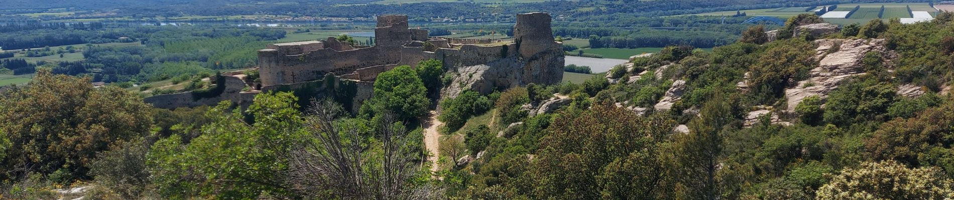
Trail Walking of 16.3 km to be discovered at Provence-Alpes-Côte d'Azur, Vaucluse, Mornas. This trail is proposed by labarone.
Description
menée par Paul
Rando tranqille sauf côte longue et pierreuse vers St Baudille Rando à éviter s'il fait trop chaud
Photos


Positioning
Country:
France
Region :
Provence-Alpes-Côte d'Azur
Department/Province :
Vaucluse
Municipality :
Mornas
Location:
Unknown
Start:(Dec)
Start:(UTM)
638275 ; 4895484 (31T) N.
Comments