


Callelongue

FSantoni
User
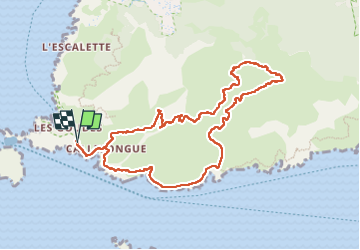

Length
10.8 km

Max alt
296 m

Uphill gradient
485 m
Km-Effort
17.3 km

Min alt
3 m

Downhill gradient
486 m
Boucle
Yes
Creation date :
2025-05-15 08:20:47.604
Updated on :
2025-05-18 16:04:26.171
5h58
Difficulty : Difficult

FREE GPS app for hiking
 SityTrail
IGN / Geographical institutes
SityTrail Plus
The world is yours!
About
Trail Walking of 10.8 km to be discovered at Provence-Alpes-Côte d'Azur, Bouches-du-Rhône, Marseille. This trail is proposed by FSantoni.
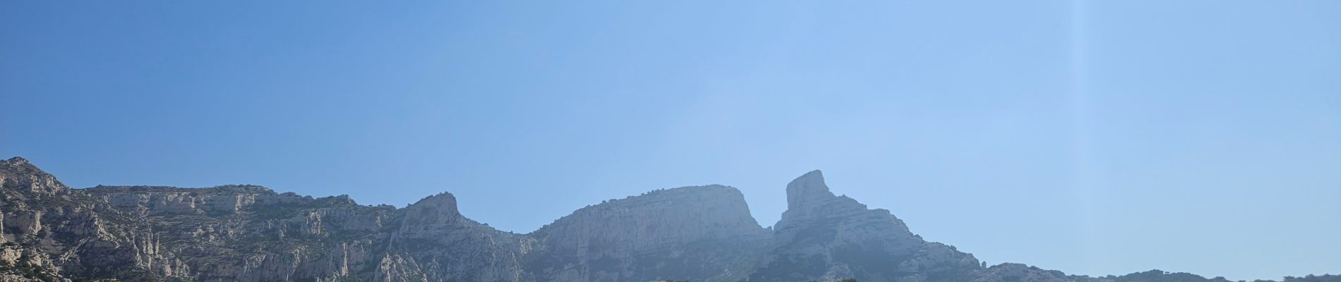
Photos


52 photos in total. Please click on a photo to see them all in the gallery.
Positioning
Country:
France
Region :
Provence-Alpes-Côte d'Azur
Department/Province :
Bouches-du-Rhône
Municipality :
Marseille
Location:
8th Arrondissement
Start:(Dec)
Start:(UTM)
690839 ; 4787199 (31T) N.
Comments