


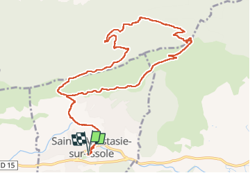
Saint Quinis - Ste Anastasie

FSantoni
User


6h26
Difficulty : Very difficult

FREE GPS app for hiking
 SityTrail
IGN / Geographical institutes
SityTrail Plus
The world is yours!
About
Trail Walking of 13.6 km to be discovered at Provence-Alpes-Côte d'Azur, Var, Sainte-Anastasie-sur-Issole. This trail is proposed by FSantoni.
Description
14 km pour 500 m de dénivelé, à partir de Ste Anastasie. Rando déjà réalisée en oct 2022. Toujours aussi agréable, avec une montée soutenue jusqu'à la chapelle.
Et en plus un bonheur de voir couler l'Issolle !
Photos


30 photos in total. Please click on a photo to see them all in the gallery.
Positioning
Comments