


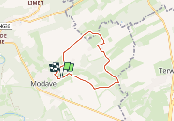
boucle Romont par la réserve naturelle du Thiers de Croix

psyberty
User


1h28
Difficulty : Medium

FREE GPS app for hiking
 SityTrail
IGN / Geographical institutes
SityTrail Plus
The world is yours!
About
Trail Walking of 5.4 km to be discovered at Wallonia, Liège, Modave. This trail is proposed by psyberty.
Description
jolie balade aux paysages très variés : champs à perte de vue, petites vallées dont la magnifique réserve naturelle du Thiers de Croix, prés, etc.
A faire par beau temps pour éviter l'eau de la réserve sur les sentiers et chemins.
Photos


Positioning
Comments