


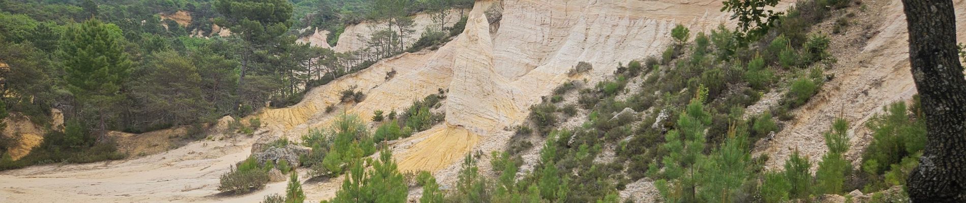
Colorado

FSantoni
User
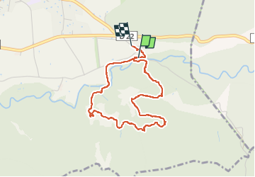

Length
3.9 km

Max alt
429 m

Uphill gradient
84 m
Km-Effort
5 km

Min alt
353 m

Downhill gradient
73 m
Boucle
Yes
Creation date :
2025-05-19 11:31:25.279
Updated on :
2025-05-19 13:07:57.233
1h36
Difficulty : Easy

FREE GPS app for hiking
 SityTrail
IGN / Geographical institutes
SityTrail Plus
The world is yours!
About
Trail Walking of 3.9 km to be discovered at Provence-Alpes-Côte d'Azur, Vaucluse, Rustrel. This trail is proposed by FSantoni.
Photos


27 photos in total. Please click on a photo to see them all in the gallery.
Positioning
Country:
France
Region :
Provence-Alpes-Côte d'Azur
Department/Province :
Vaucluse
Municipality :
Rustrel
Location:
Unknown
Start:(Dec)
Start:(UTM)
700765 ; 4865835 (31T) N.
Comments