


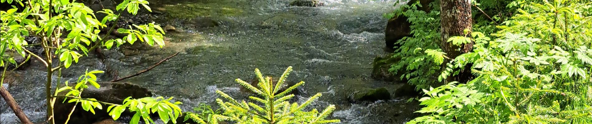
Le sentier du Renard en passant par la cascade de Nyon

micheldutilleul
User
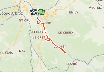

Length
10.4 km

Max alt
1124 m

Uphill gradient
257 m
Km-Effort
13.8 km

Min alt
961 m

Downhill gradient
257 m
Boucle
Yes
Creation date :
2025-05-21 10:34:14.239
Updated on :
2025-05-21 15:59:10.912
3h08
Difficulty : Difficult

FREE GPS app for hiking
 SityTrail
IGN / Geographical institutes
SityTrail Plus
The world is yours!
About
Trail Walking of 10.4 km to be discovered at Auvergne-Rhône-Alpes, Upper Savoy, Morzine. This trail is proposed by micheldutilleul.
Photos


Positioning
Country:
France
Region :
Auvergne-Rhône-Alpes
Department/Province :
Upper Savoy
Municipality :
Morzine
Location:
Unknown
Start:(Dec)
Start:(UTM)
322627 ; 5116975 (32T) N.
Comments