


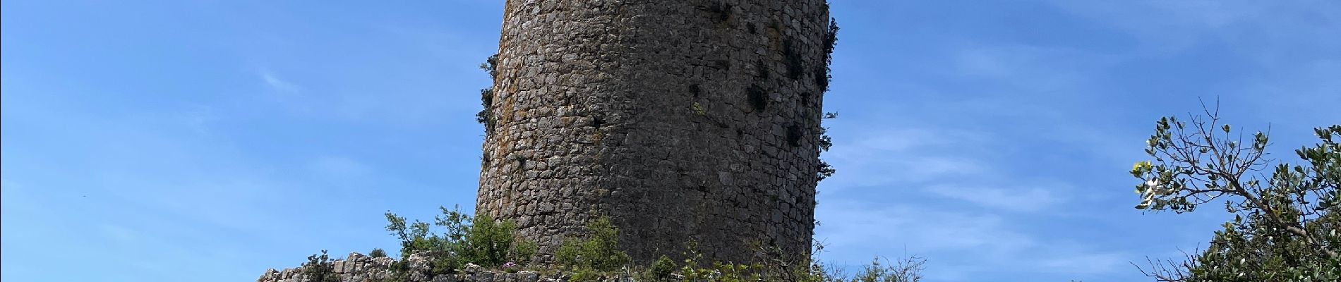
Tautavel. Tour del far

robertperello
User
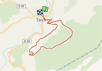

Length
9.9 km

Max alt
481 m

Uphill gradient
468 m
Km-Effort
16.1 km

Min alt
95 m

Downhill gradient
457 m
Boucle
No
Creation date :
2025-05-21 07:23:29.0
Updated on :
2025-05-21 14:05:50.979
3h56
Difficulty : Difficult

FREE GPS app for hiking
 SityTrail
IGN / Geographical institutes
SityTrail Plus
The world is yours!
About
Trail Walking of 9.9 km to be discovered at Occitania, Pyrénées-Orientales, Tautavel. This trail is proposed by robertperello.
Description
Pking: boulodrome. Rando difficile avec des passages dangereux avec beaucoup d’éboulis
Photos


Positioning
Country:
France
Region :
Occitania
Department/Province :
Pyrénées-Orientales
Municipality :
Tautavel
Location:
Unknown
Start:(Dec)
Start:(UTM)
479063 ; 4740333 (31T) N.
Comments