


Pierre Percée Est Var chateau

noelphil
User
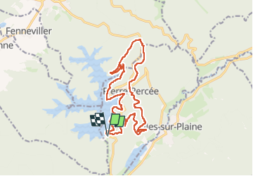

Length
17 km

Max alt
541 m

Uphill gradient
470 m
Km-Effort
23 km

Min alt
381 m

Downhill gradient
469 m
Boucle
Yes
Creation date :
2025-05-22 06:57:38.884
Updated on :
2025-05-22 13:44:05.875
5h29
Difficulty : Very difficult

FREE GPS app for hiking
 SityTrail
IGN / Geographical institutes
SityTrail Plus
The world is yours!
About
Trail Walking of 17 km to be discovered at Grand Est, Meurthe-et-Moselle, Pierre-Percée. This trail is proposed by noelphil.
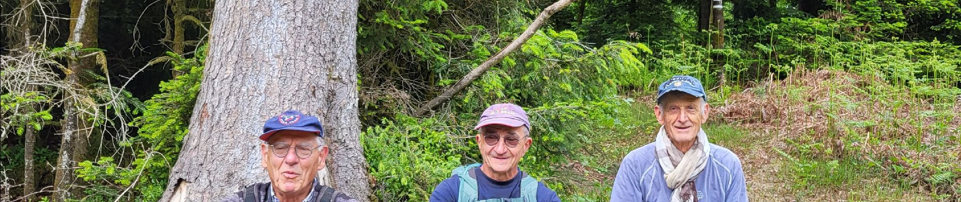
Photos


Positioning
Country:
France
Region :
Grand Est
Department/Province :
Meurthe-et-Moselle
Municipality :
Pierre-Percée
Location:
Unknown
Start:(Dec)
Start:(UTM)
346315 ; 5368840 (32U) N.
Comments