


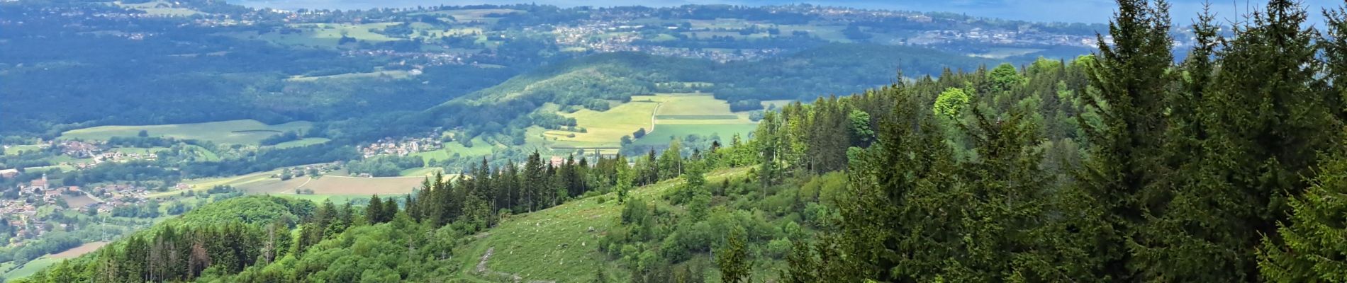
Mont Forchat

micheldutilleul
User
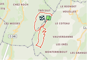

Length
7.3 km

Max alt
1524 m

Uphill gradient
388 m
Km-Effort
12.4 km

Min alt
1169 m

Downhill gradient
388 m
Boucle
Yes
Creation date :
2025-05-23 09:31:33.846
Updated on :
2025-05-23 17:17:21.876
2h49
Difficulty : Difficult

FREE GPS app for hiking
 SityTrail
IGN / Geographical institutes
SityTrail Plus
The world is yours!
About
Trail Walking of 7.3 km to be discovered at Auvergne-Rhône-Alpes, Upper Savoy, Lullin. This trail is proposed by micheldutilleul.
Photos

Positioning
Country:
France
Region :
Auvergne-Rhône-Alpes
Department/Province :
Upper Savoy
Municipality :
Lullin
Location:
Unknown
Start:(Dec)
Start:(UTM)
306762 ; 5128838 (32T) N.
Comments