


Tour del Mir depuis Prats de Mollo

fpa
User
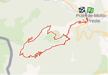

Length
15.8 km

Max alt
1536 m

Uphill gradient
870 m
Km-Effort
27 km

Min alt
732 m

Downhill gradient
871 m
Boucle
Yes
Creation date :
2025-05-23 06:19:54.918
Updated on :
2025-05-23 13:01:19.833
6h24
Difficulty : Medium

FREE GPS app for hiking
 SityTrail
IGN / Geographical institutes
SityTrail Plus
The world is yours!
About
Trail Walking of 15.8 km to be discovered at Occitania, Pyrénées-Orientales, Prats-de-Mollo-la-Preste. This trail is proposed by fpa.
Photos

Positioning
Country:
France
Region :
Occitania
Department/Province :
Pyrénées-Orientales
Municipality :
Prats-de-Mollo-la-Preste
Location:
Unknown
Start:(Dec)
Start:(UTM)
457084 ; 4694667 (31T) N.
Comments