


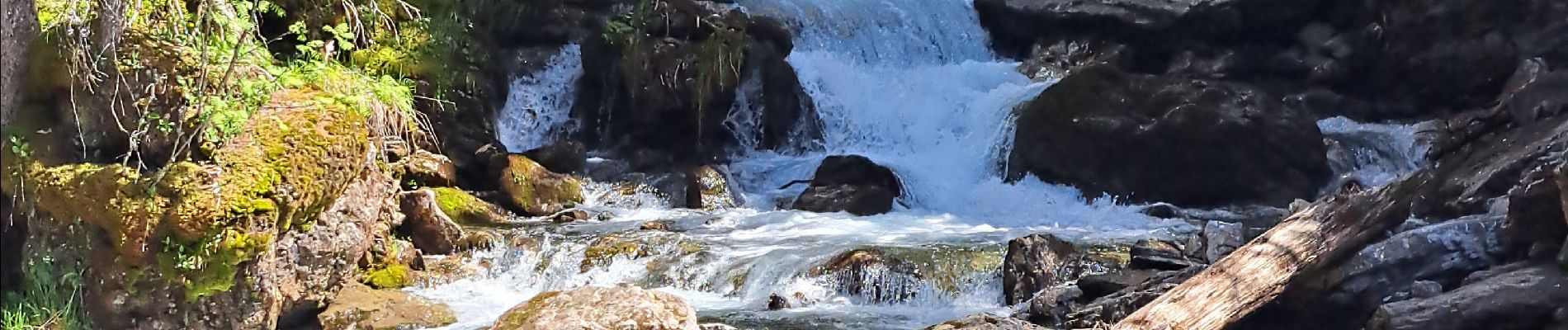
Cascade d'Ardent- Les Lindarets

micheldutilleul
User
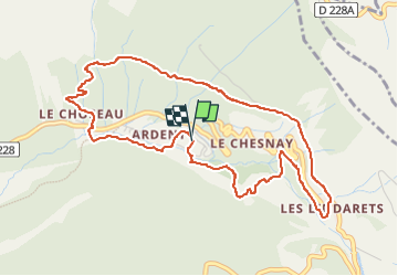

Length
5.3 km

Max alt
1520 m

Uphill gradient
352 m
Km-Effort
10 km

Min alt
1193 m

Downhill gradient
355 m
Boucle
Yes
Creation date :
2025-05-24 12:16:18.27
Updated on :
2025-05-25 13:18:25.168
2h16
Difficulty : Difficult

FREE GPS app for hiking
 SityTrail
IGN / Geographical institutes
SityTrail Plus
The world is yours!
About
Trail Walking of 5.3 km to be discovered at Auvergne-Rhône-Alpes, Upper Savoy, Montriond. This trail is proposed by micheldutilleul.
Description
Traversées de plusieurs cascades et certaines à flanc de colline ! Déconseillé aux enfants ! Bonnes chaussures !
Photos


Positioning
Country:
France
Region :
Auvergne-Rhône-Alpes
Department/Province :
Upper Savoy
Municipality :
Montriond
Location:
Unknown
Start:(Dec)
Start:(UTM)
327450 ; 5120319 (32T) N.
Comments