


monts de fun

phil21
User
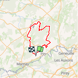

Length
47 km

Max alt
394 m

Uphill gradient
1018 m
Km-Effort
60 km

Min alt
210 m

Downhill gradient
1022 m
Boucle
Yes
Creation date :
2015-07-19 00:00:00.0
Updated on :
2015-07-19 00:00:00.0
4h15
Difficulty : Easy

FREE GPS app for hiking
 SityTrail
IGN / Geographical institutes
SityTrail Plus
The world is yours!
About
Trail Mountain bike of 47 km to be discovered at Bourgogne-Franche-Comté, Haute-Saône, Beaumotte-lès-Pin. This trail is proposed by phil21.
Positioning
Country:
France
Region :
Bourgogne-Franche-Comté
Department/Province :
Haute-Saône
Municipality :
Beaumotte-lès-Pin
Location:
Unknown
Start:(Dec)
Start:(UTM)
714065 ; 5244025 (31T) N.
Comments