


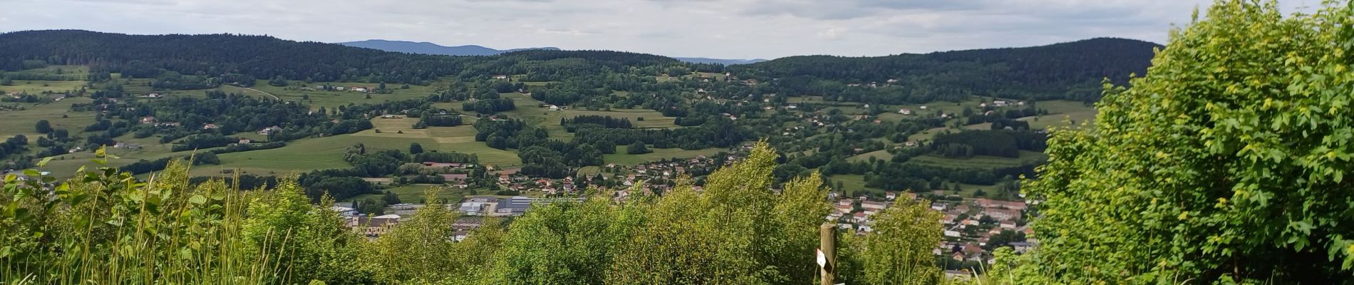
fraize

ISAGIL
User
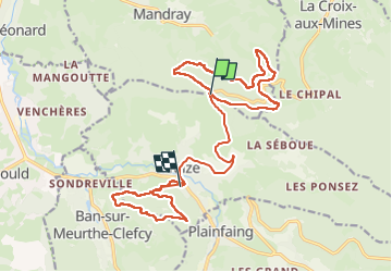

Length
20 km

Max alt
751 m

Uphill gradient
555 m
Km-Effort
28 km

Min alt
500 m

Downhill gradient
744 m
Boucle
No
Creation date :
2025-05-27 07:24:49.451
Updated on :
2025-05-27 15:19:22.887
5h32
Difficulty : Very difficult

FREE GPS app for hiking
 SityTrail
IGN / Geographical institutes
SityTrail Plus
The world is yours!
About
Trail Walking of 20 km to be discovered at Grand Est, Vosges, Fraize. This trail is proposed by ISAGIL.
Photos

Positioning
Country:
France
Region :
Grand Est
Department/Province :
Vosges
Municipality :
Fraize
Location:
Unknown
Start:(Dec)
Start:(UTM)
352254 ; 5340629 (32U) N.
Comments