


traversée des hauts plateaux du vercors

trailer38
User
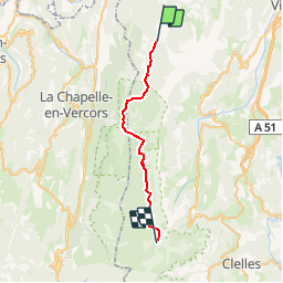

Length
25 km

Max alt
1931 m

Uphill gradient
1138 m
Km-Effort
38 km

Min alt
1143 m

Downhill gradient
368 m
Boucle
No
Creation date :
2015-07-23 00:00:00.0
Updated on :
2015-07-23 00:00:00.0
5h00
Difficulty : Unknown

FREE GPS app for hiking
 SityTrail
IGN / Geographical institutes
SityTrail Plus
The world is yours!
About
Trail Running of 25 km to be discovered at Auvergne-Rhône-Alpes, Isère, Corrençon-en-Vercors. This trail is proposed by trailer38.
Positioning
Country:
France
Region :
Auvergne-Rhône-Alpes
Department/Province :
Isère
Municipality :
Corrençon-en-Vercors
Location:
Unknown
Start:(Dec)
Start:(UTM)
698363 ; 4988756 (31T) N.
Comments