


Col du Bougnon

Pascal-83
User
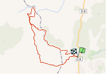

Length
10.6 km

Max alt
341 m

Uphill gradient
388 m
Km-Effort
15.8 km

Min alt
57 m

Downhill gradient
393 m
Boucle
Yes
Creation date :
2025-05-29 06:01:25.235
Updated on :
2025-05-29 10:01:36.763
3h59
Difficulty : Difficult

FREE GPS app for hiking
 SityTrail
IGN / Geographical institutes
SityTrail Plus
The world is yours!
About
Trail Walking of 10.6 km to be discovered at Provence-Alpes-Côte d'Azur, Var, Roquebrune-sur-Argens. This trail is proposed by Pascal-83.
Description
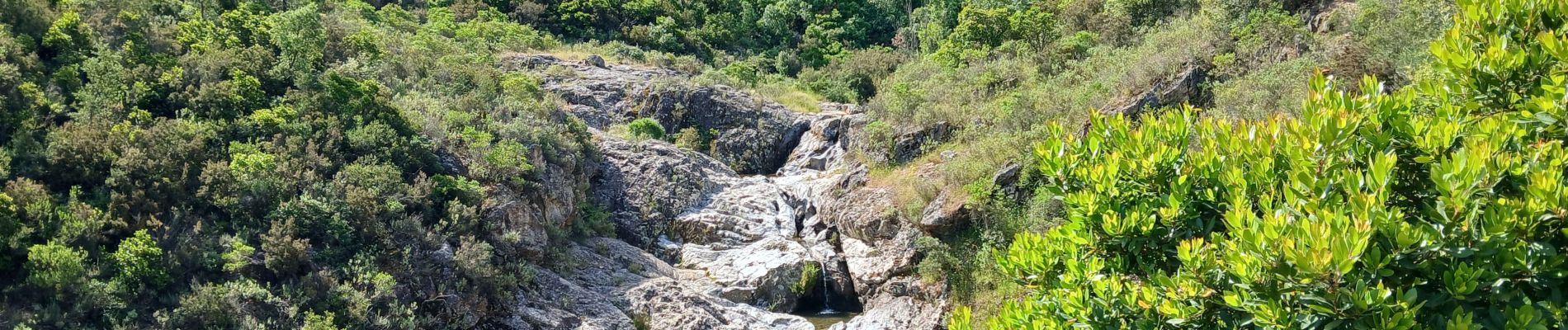
marche Roquebrune Amitié
Photos

Positioning
Country:
France
Region :
Provence-Alpes-Côte d'Azur
Department/Province :
Var
Municipality :
Roquebrune-sur-Argens
Location:
Unknown
Start:(Dec)
Start:(UTM)
311451 ; 4803863 (32T) N.
Comments