


majastres

montagne06
User

Length
14.8 km

Max alt
1748 m

Uphill gradient
734 m
Km-Effort
25 km

Min alt
1142 m

Downhill gradient
736 m
Boucle
Yes
Creation date :
2025-05-29 06:19:23.782
Updated on :
2025-05-29 12:48:39.939
6h28
Difficulty : Difficult

FREE GPS app for hiking
 SityTrail
IGN / Geographical institutes
SityTrail Plus
The world is yours!
About
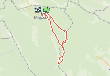
Trail Walking of 14.8 km to be discovered at Provence-Alpes-Côte d'Azur, Alpes-de-Haute-Provence, Majastres. This trail is proposed by montagne06.
Positioning
Country:
France
Region :
Provence-Alpes-Côte d'Azur
Department/Province :
Alpes-de-Haute-Provence
Municipality :
Majastres
Location:
Unknown
Start:(Dec)
Start:(UTM)
282318 ; 4865930 (32T) N.
Comments