


La Voie Sarde - 29 mai 2025

morganee
User
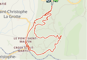

Length
7.1 km

Max alt
599 m

Uphill gradient
311 m
Km-Effort
11.3 km

Min alt
419 m

Downhill gradient
311 m
Boucle
Yes
Creation date :
2025-05-29 12:09:24.729
Updated on :
2025-05-29 16:09:24.667
2h45
Difficulty : Easy

FREE GPS app for hiking
 SityTrail
IGN / Geographical institutes
SityTrail Plus
The world is yours!
About
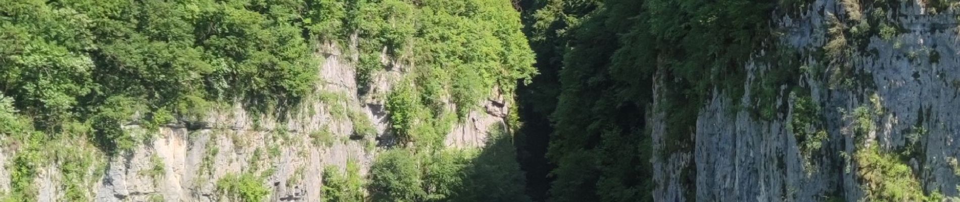
Trail Walking of 7.1 km to be discovered at Auvergne-Rhône-Alpes, Savoy, Saint-Christophe. This trail is proposed by morganee.
Photos

Positioning
Country:
France
Region :
Auvergne-Rhône-Alpes
Department/Province :
Savoy
Municipality :
Saint-Christophe
Location:
Unknown
Start:(Dec)
Start:(UTM)
718309 ; 5037024 (31T) N.
Comments