


Costabonne en boucle

fpa
User

Length
20 km

Max alt
2452 m

Uphill gradient
1348 m
Km-Effort
38 km

Min alt
1114 m

Downhill gradient
1351 m
Boucle
Yes
Creation date :
2025-05-30 04:17:56.133
Updated on :
2025-05-30 15:47:54.199
11h28
Difficulty : Very difficult

FREE GPS app for hiking
 SityTrail
IGN / Geographical institutes
SityTrail Plus
The world is yours!
About
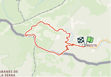
Trail Walking of 20 km to be discovered at Occitania, Pyrénées-Orientales, Prats-de-Mollo-la-Preste. This trail is proposed by fpa.
Positioning
Country:
France
Region :
Occitania
Department/Province :
Pyrénées-Orientales
Municipality :
Prats-de-Mollo-la-Preste
Location:
Unknown
Start:(Dec)
Start:(UTM)
450764 ; 4695142 (31T) N.
Comments