


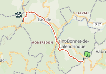
Nougarède - Official path to Lassales's river

sebastienu
User

Length
5.1 km

Max alt
401 m

Uphill gradient
78 m
Km-Effort
6.3 km

Min alt
259 m

Downhill gradient
151 m
Boucle
No
Creation date :
2025-05-31 07:41:35.978
Updated on :
2025-05-31 09:54:15.071
1h17
Difficulty : Very easy

FREE GPS app for hiking
 SityTrail
IGN / Geographical institutes
SityTrail Plus
The world is yours!
About
Trail Walking of 5.1 km to be discovered at Occitania, Gard, Vabres. This trail is proposed by sebastienu.
Description
Intérêt local
Positioning
Country:
France
Region :
Occitania
Department/Province :
Gard
Municipality :
Vabres
Location:
Unknown
Start:(Dec)
Start:(UTM)
570263 ; 4875335 (31T) N.
Comments