


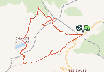
LE JALLOUVRE/POINTE BLANCHE/LESSY (13 Km, 1300 m d+).

DUCLUZEAU
User

Length
12.8 km

Max alt
2354 m

Uphill gradient
1299 m
Km-Effort
30 km

Min alt
1427 m

Downhill gradient
1305 m
Boucle
Yes
Creation date :
2025-06-02 12:04:18.099
Updated on :
2025-06-02 12:05:33.591
6h50
Difficulty : Difficult

FREE GPS app for hiking
 SityTrail
IGN / Geographical institutes
SityTrail Plus
The world is yours!
About
Trail Walking of 12.8 km to be discovered at Auvergne-Rhône-Alpes, Upper Savoy, Le Reposoir. This trail is proposed by DUCLUZEAU.
Positioning
Country:
France
Region :
Auvergne-Rhône-Alpes
Department/Province :
Upper Savoy
Municipality :
Le Reposoir
Location:
Unknown
Start:(Dec)
Start:(UTM)
304500 ; 5096289 (32T) N.
Comments