


rando cham joinville cham modifiée

Cat'April
User
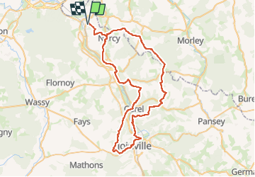

Length
67 km

Max alt
346 m

Uphill gradient
1167 m
Km-Effort
83 km

Min alt
162 m

Downhill gradient
1167 m
Boucle
Yes
Creation date :
2025-06-02 13:26:42.432
Updated on :
2025-06-02 13:26:52.444
10h52
Difficulty : Very difficult

FREE GPS app for hiking
 SityTrail
IGN / Geographical institutes
SityTrail Plus
The world is yours!
About
Trail Horseback riding of 67 km to be discovered at Grand Est, Haute-Marne, Chamouilley. This trail is proposed by Cat'April.
Positioning
Country:
France
Region :
Grand Est
Department/Province :
Haute-Marne
Municipality :
Chamouilley
Location:
Unknown
Start:(Dec)
Start:(UTM)
651027 ; 5385056 (31U) N.
Comments