Trail Walking Vallorcine - a Albert Premier 20150721 - Photo
 mrioux
mrioux

User

© OpenStreetMap contributors
Length
Length
18.8 km
Max alt
Max alt
2710 m
Uphill gradient
Uphill gradient
1042 m
Km-Effort
Km-Effort  
35 km
Min alt
Min alt
1365 m
Downhill gradient
Downhill gradient
1608 m
Boucle
Boucle
No
Creation date :
2016-12-29 00:00:00.0
Updated on :
2016-12-29 00:00:00.0

(0 Reviews)

Walking
Walking
6h38
Difficulty : Very difficult

Scan this QR Code to open this trail in the SityTrail application

FREE GPS app for hiking

Logo SityTrail SityTrail

IGN / Geographical institutes

Download SityTrail from the App Store Download SityTrail from Google Play

Logo SityTrail SityTrail World

The world is yours!

Download SityTrail from the App Store Download SityTrail from Google Play Download SityTrail on Huawei AppGallery

About

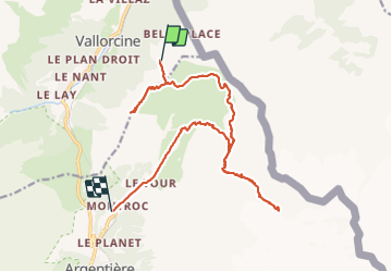
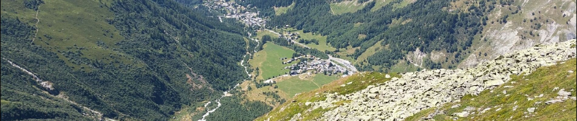
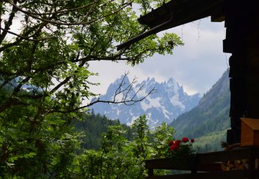
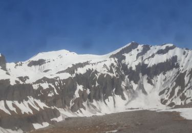
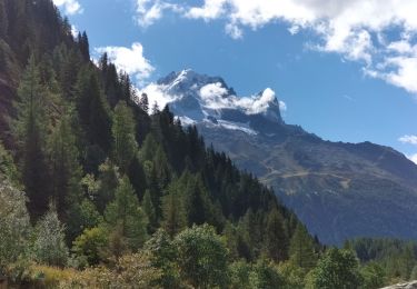
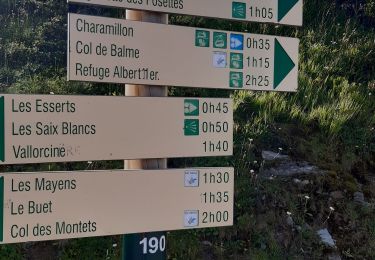
Trail Walking of 18.8 km to be discovered at Auvergne-Rhône-Alpes, Upper Savoy, Vallorcine. This trail is proposed by mrioux.

Description

départ vallorcines, puis télécabines
retour par le train
le temps inclus toutes les pauses !!!

Elevation profile

Photos

Positioning

Country:
France
Region :
Auvergne-Rhône-Alpes
Department/Province :
Upper Savoy
Municipality :
Vallorcine
Location:
Unknown
Start:(UTM)
341312 ; 5099394 (32T) N.

Trails nearby

Trail Walking Vallorcine - Le Buet - Vallorcine - Photo
Walking
tracegps

Walking

Difficult
(1)
Vallorcine, Auvergne-Rhône-Alpes, Upper Savoy, France
9 km | 27 km-effort
7h 0min
No
Trail Mountain bike Trient - Tour du Mont Blanc VTT - La Forclaz à La Fouly - Photo
Mountain bike
tracegps

Mountain bike

Difficult
(1)
Trient, Valais/Wallis, Martigny, Switzerland
31 km | 52 km-effort
3h 49min
No
Trail Winter sports Vallorcine - vers Finhaut - Photo
Winter sports
fpitance

Winter sports

Medium
(1)
Vallorcine, Auvergne-Rhône-Alpes, Upper Savoy, France
22 km | 40 km-effort
5h 0min
No
Trail Walking Chamonix-Mont-Blanc - Randonnée dans la Vallée de Chamonix - Photo
Walking
jeff2

Walking

Easy
Chamonix-Mont-Blanc, Auvergne-Rhône-Alpes, Upper Savoy, France
12.5 km | 15.3 km-effort
3h 13min
No
Trail Walking Chamonix-Mont-Blanc - Les aiguilles Rouges Chamonix Argentière  - Photo
Walking
jcboutin

Walking

Difficult
Chamonix-Mont-Blanc, Auvergne-Rhône-Alpes, Upper Savoy, France
11.9 km | 25 km-effort
7h 32min
Yes
Trail Walking Vallorcine - Vallorcine - Fontaine Froide - Sur le Rocher - Côte du Nant - Photo
Walking
LtZIP

Walking

Medium
Vallorcine, Auvergne-Rhône-Alpes, Upper Savoy, France
6.3 km | 10.3 km-effort
2h 19min
Yes
Trail Touring skiing Finhaut - pointe de la terrasse  - Photo
Touring skiing
carton-fils@orange.fr

Touring skiing

Very easy
Finhaut, Valais/Wallis, Saint-Maurice, Switzerland
8.7 km | 19 km-effort
3h 14min
No
Trail Walking Chamonix-Mont-Blanc - TMB8 CAF 24 - Photo
Walking
reneperrin

Walking

Very difficult
Chamonix-Mont-Blanc, Auvergne-Rhône-Alpes, Upper Savoy, France
17.5 km | 33 km-effort
7h 33min
No
Trail Walking Vallorcine - téléphérique Vallorcine,col de Balme,aiguillettes des Posettes Montroc - Photo
Walking
marianne guichoux

Walking

Easy
Vallorcine, Auvergne-Rhône-Alpes, Upper Savoy, France
11.2 km | 19.4 km-effort
3h 28min
No


Close
My subscriptions