


Baixas (chapelle ste Catherine). Calce

robertperello
User
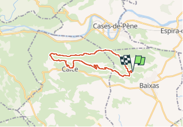

Length
13.2 km

Max alt
323 m

Uphill gradient
334 m
Km-Effort
17.7 km

Min alt
124 m

Downhill gradient
334 m
Boucle
Yes
Creation date :
2025-06-04 07:00:52.0
Updated on :
2025-06-04 13:33:34.316
3h47
Difficulty : Medium

FREE GPS app for hiking
 SityTrail
IGN / Geographical institutes
SityTrail Plus
The world is yours!
About
Trail Walking of 13.2 km to be discovered at Occitania, Pyrénées-Orientales, Baixas. This trail is proposed by robertperello.
Description
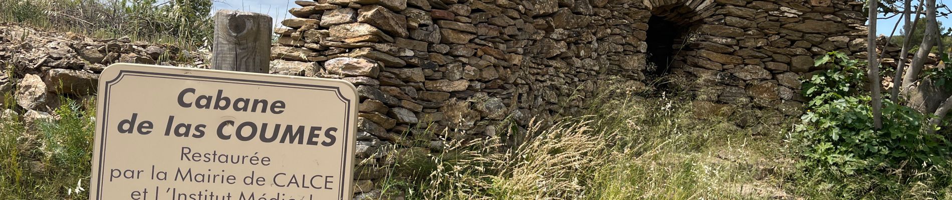
Rando très caillouteuse Château de Calce
Photos
. Calce - Photo 1")
Positioning
Country:
France
Region :
Occitania
Department/Province :
Pyrénées-Orientales
Municipality :
Baixas
Location:
Unknown
Start:(Dec)
Start:(UTM)
483490 ; 4733803 (31T) N.
Comments